
A collaboration with MIT, City of Cincinnati, and 3DStreet

Context and Challenge
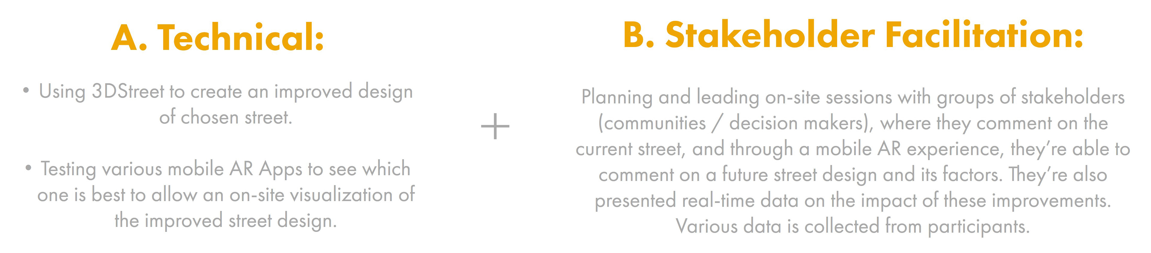
This project represents a major collaboration between the Future Mobility Design Lab, the MIT Media Lab, and 3DStreet, with local implementation support from the City of Cincinnati. The goal was to develop and validate a scalable, technology enabled and participatory methodology that allows communities and decision makers to better understand, evaluate, and co design future streets and neighborhoods. The project focused on lowering barriers to participation by combining mobile augmented reality, data driven design, and structured facilitation, enabling stakeholders to engage directly with future scenarios on site and in context. The two main components were:
Phase 1, Technology Review and Site Selection
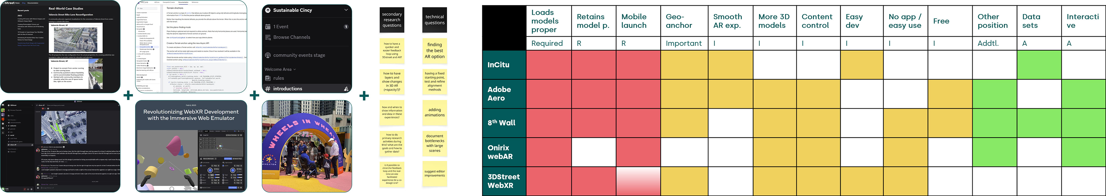
The first phase focused on establishing a strong technical and methodological foundation. This included a state of the art review of existing mobile AR applications, assessing their capabilities, limitations, accessibility, and strategic value for participatory urban planning. A comparative framework was developed to evaluate each platform based on criteria such as usability, scalability, data integration, device compatibility, and suitability for community engagement. In parallel, a real world location in Cincinnati was selected to serve as the testbed for the methodology, ensuring that the pilot would be grounded in an active urban context with real planning relevance.
The first phase focused on establishing a strong technical and methodological foundation. This included a state of the art review of existing mobile AR applications, assessing their capabilities, limitations, accessibility, and strategic value for participatory urban planning. A comparative framework was developed to evaluate each platform based on criteria such as usability, scalability, data integration, device compatibility, and suitability for community engagement. In parallel, a real world location in Cincinnati was selected to serve as the testbed for the methodology, ensuring that the pilot would be grounded in an active urban context with real planning relevance.
State-of-the-art Mobile AR App secondary research sample & Comparative framework Analysis

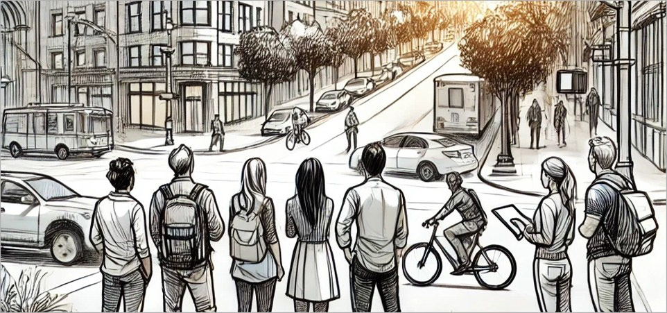
Site location outside UC Digital Futures Building
Phase 2, Technical Development and Pilot Preparation
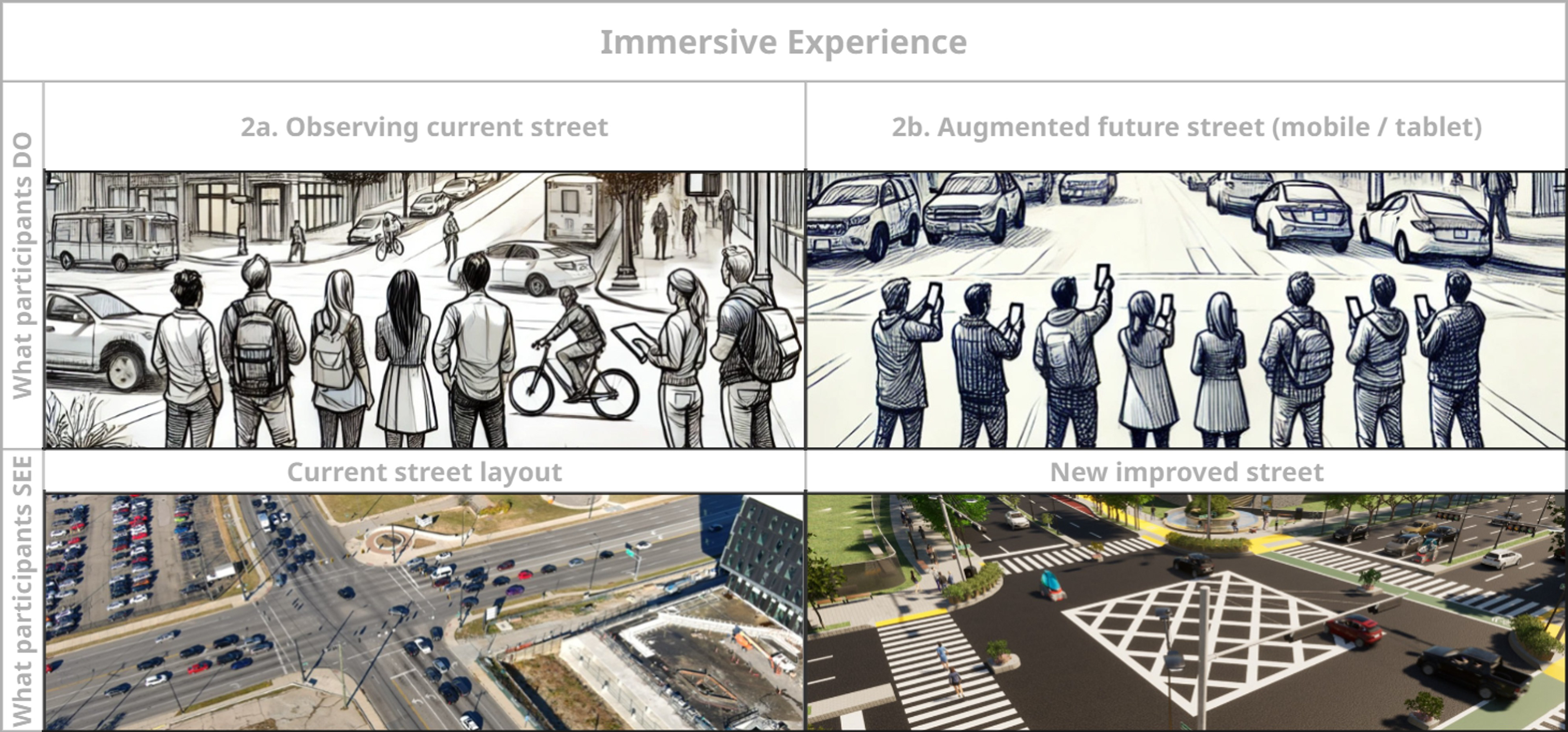
The second phase centered on preparing the technical assets and participatory materials required for the pilot. This included selecting the final test location and generating accurate spatial data through scans and surveys. Using these inputs, the team developed a detailed 3D urban street model representing an improved future condition, incorporating enhanced multimodal mobility access, green and urban infrastructure, and mixed use development strategies. These designs were translated into a mobile AR experience using the selected toolchain, ensuring that participants could visualize and interact with future scenarios directly on site and at a human scale.
The second phase centered on preparing the technical assets and participatory materials required for the pilot. This included selecting the final test location and generating accurate spatial data through scans and surveys. Using these inputs, the team developed a detailed 3D urban street model representing an improved future condition, incorporating enhanced multimodal mobility access, green and urban infrastructure, and mixed use development strategies. These designs were translated into a mobile AR experience using the selected toolchain, ensuring that participants could visualize and interact with future scenarios directly on site and at a human scale.
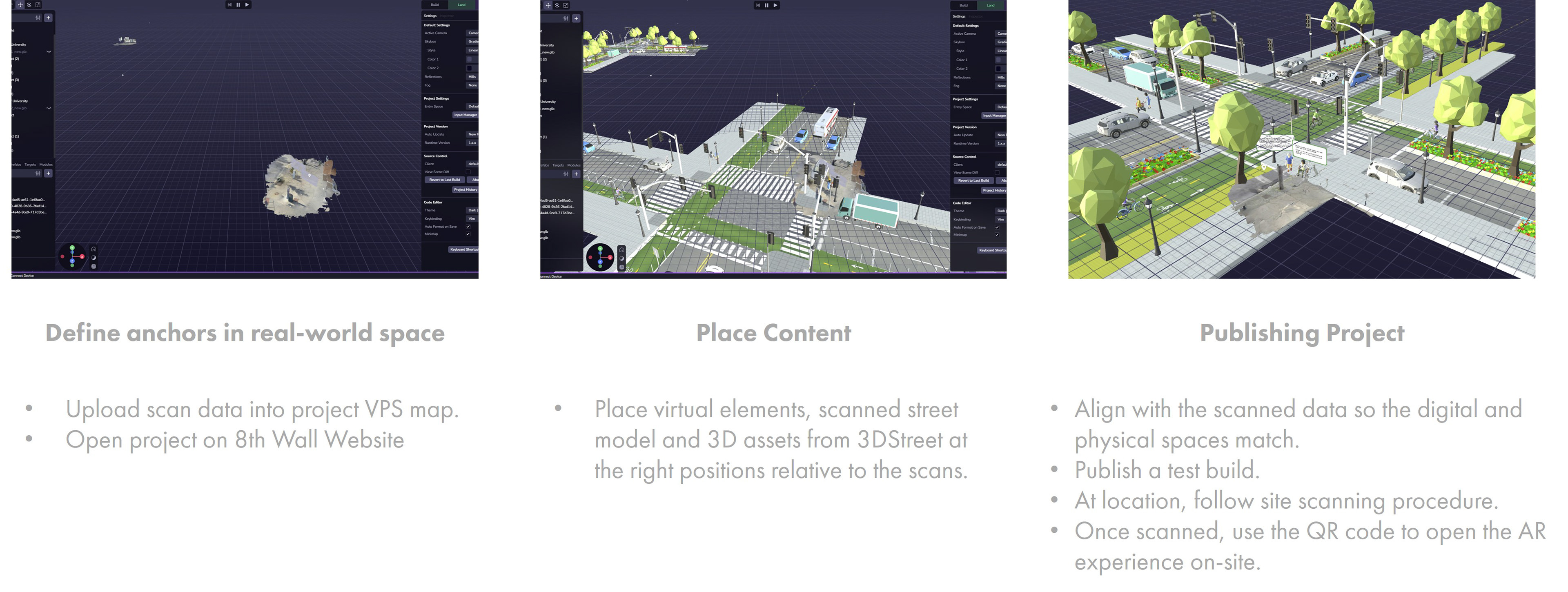
3D Street design development
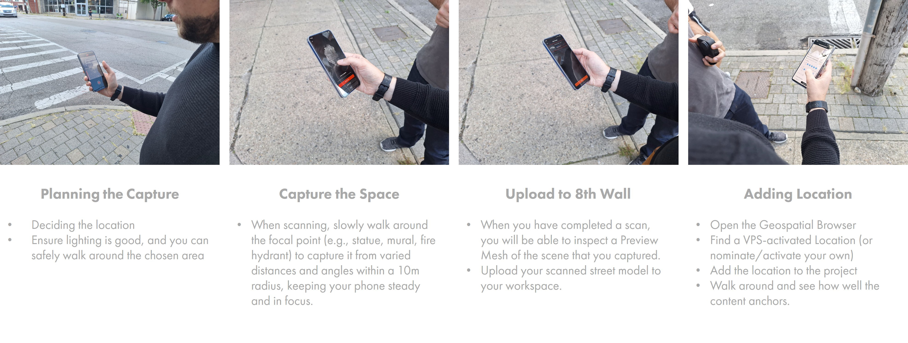
On-site preparation and scanning

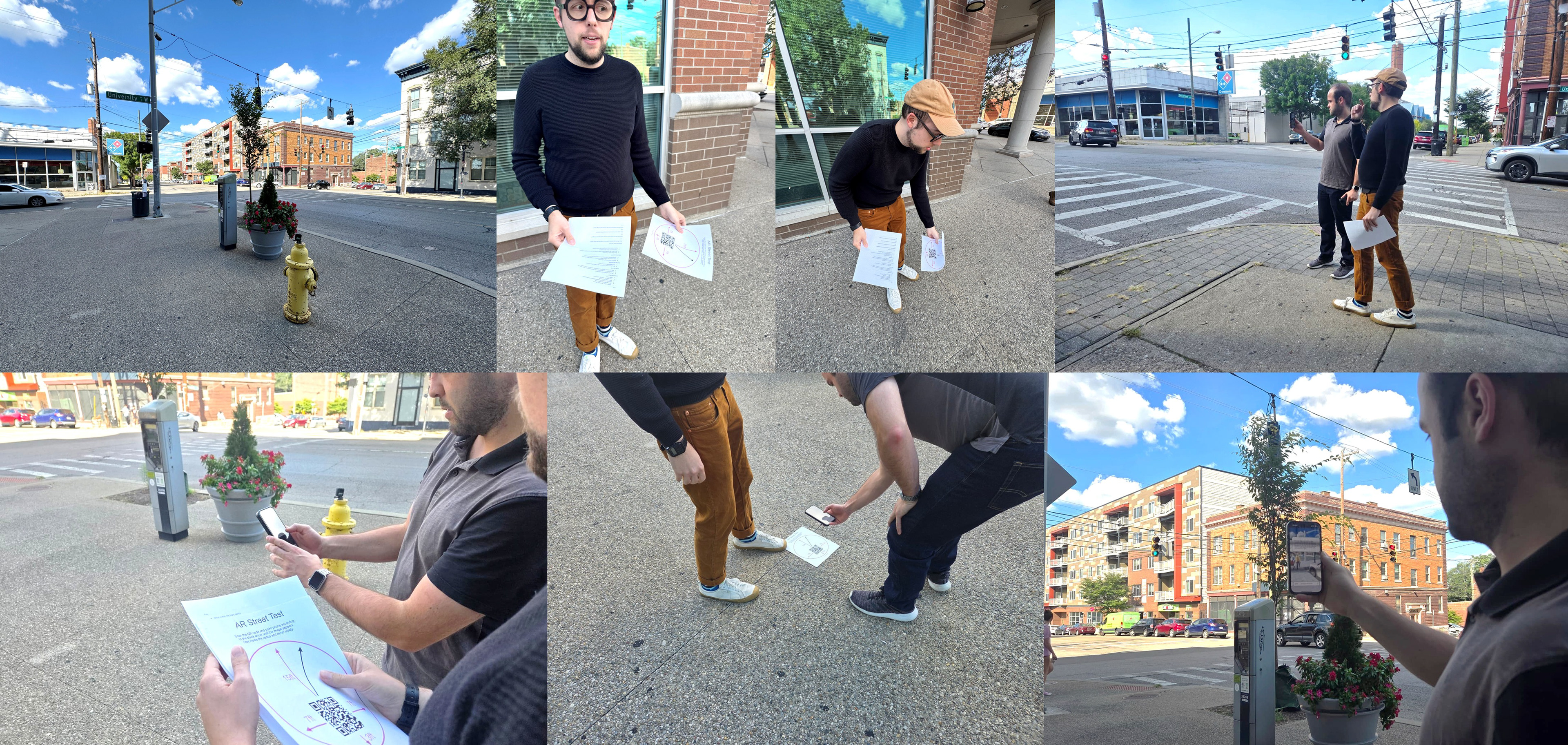
Final Test location
Phase 3, On Site Participatory Facilitation
The third phase consisted of the live, on site participatory session where all methodological components were tested together. Community members, stakeholders, and decision makers were guided through a structured facilitation process that combined storytelling, AR visualization, and mixed methods data collection. Participants engaged with both the current and proposed future street conditions, providing qualitative feedback, reactions, and insights informed by their lived experience. This phase also assessed the effectiveness of the tools, facilitation structure, and data collection approach, identifying strengths, gaps, and opportunities for refinement.
The third phase consisted of the live, on site participatory session where all methodological components were tested together. Community members, stakeholders, and decision makers were guided through a structured facilitation process that combined storytelling, AR visualization, and mixed methods data collection. Participants engaged with both the current and proposed future street conditions, providing qualitative feedback, reactions, and insights informed by their lived experience. This phase also assessed the effectiveness of the tools, facilitation structure, and data collection approach, identifying strengths, gaps, and opportunities for refinement.

Final workshop framework
Final simulation
Final simulation 360 video recordings
Conclusions and Next Steps
The project successfully demonstrated the potential of mobile AR as a powerful participation and decision making tool for urban planning. By integrating accessible technology with human centered facilitation, the methodology improved understanding, engagement, and the quality of feedback compared to traditional approaches. The outcomes validated the technical pipeline and participatory framework, positioning the methodology for further pilots and broader adoption. Interest from cities in the U.S. and governments in countries such as Chile and Colombia is already shaping next steps, which include expanded pilots, additional funding pathways, academic publications, and the development of a scalable toolkit to support community centered, future ready urban governance.
The project successfully demonstrated the potential of mobile AR as a powerful participation and decision making tool for urban planning. By integrating accessible technology with human centered facilitation, the methodology improved understanding, engagement, and the quality of feedback compared to traditional approaches. The outcomes validated the technical pipeline and participatory framework, positioning the methodology for further pilots and broader adoption. Interest from cities in the U.S. and governments in countries such as Chile and Colombia is already shaping next steps, which include expanded pilots, additional funding pathways, academic publications, and the development of a scalable toolkit to support community centered, future ready urban governance.