Leading a multi year research initiative with the ODOT, spanning $500,000 in funded projects, an implementable statewide framework for community and mobility hubs, and a globally scalable methodology now being adapted across the U.S., Global South, and Europe to improve quality of life and access to essential services.
Timeline: Research grants from 2023-2024 and 3 until 2027.
Industry: Transportation
Roles: Principal Investigator and Project Leader.
Team included PM and 2 experts from the ODOT, 2 faculty advisors from engineering, and 10+ multidisciplinary undergraduate and graduate students.
Funding Amount: $100,000 USD and then $450,000 USD
Results and Impact
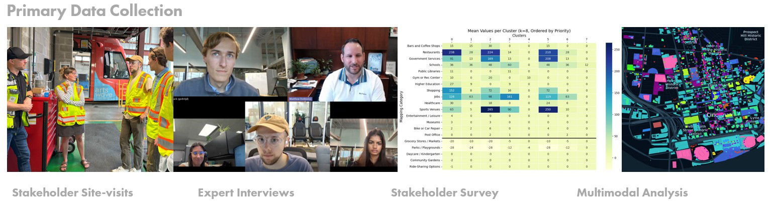
• Delivered IRB Approved foundational UX research, including 20+ stakeholder interviews across government, education, mobility, healthcare, and local business, and 80+ statewide survey responses, aligning stakeholders around a shared future vision for community and mobility hubs.
• Produced a Future Hubs Playbook and a final research report now used by ODOT to guide stakeholder workshops, evaluate hub concepts, and inform long-term strategy and planning.
• Applied 20+ UX research frameworks, Generative AI tools, and developed 9 Digital Twin hub concepts, with outcomes leading to 3 additional ODOT grants to continue and scale this work.
• Focus: Supporting ODOT in developing a user-centered, statewide framework that addresses current community needs while anticipating future demands, enabling inclusive access to mobility, education, healthcare, employment, and essential services.
• Methods: Applied 20+ UX research and mixed methods, Generative AI scenario building and co-design, STEEP analysis, service blueprinting, participatory co-design, Digital Twin development, and AI-enabled interview and dataset coding to support future-ready community and mobility hub planning.
• Confidentiality: Frameworks and methods are publicly shareable, while all quantitative and qualitative data collected is the property of ODOT.
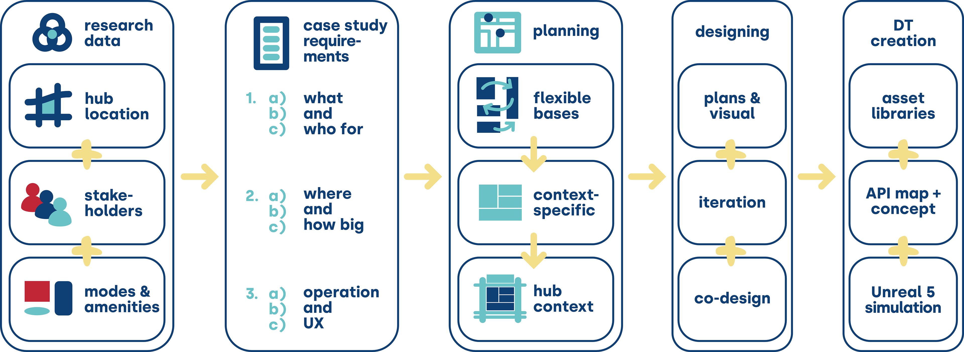
Research Process
•Delivered a 1-year, 3-phase research initiative (2023–2024) with the Ohio Department of Transportation, led by a 10+ person multidisciplinary team including design, engineering, planning, computer science, working alongside ODOT consultants and project managers, and expanded into 3 additional funded projects through 2027 (~$500K total).
•Produced an implementable, policy-aligned framework for community and mobility hubs across urban, suburban, and rural contexts, now being adapted nationally and internationally in collaboration with the MIT City Science Network and partners in the Global South and Europe.
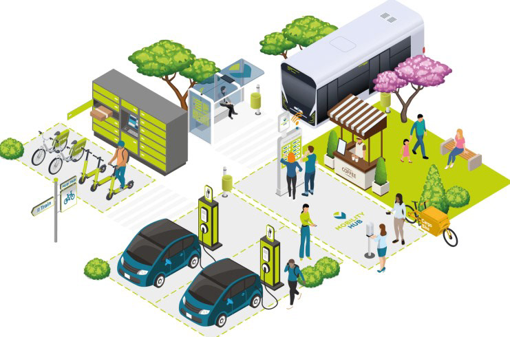
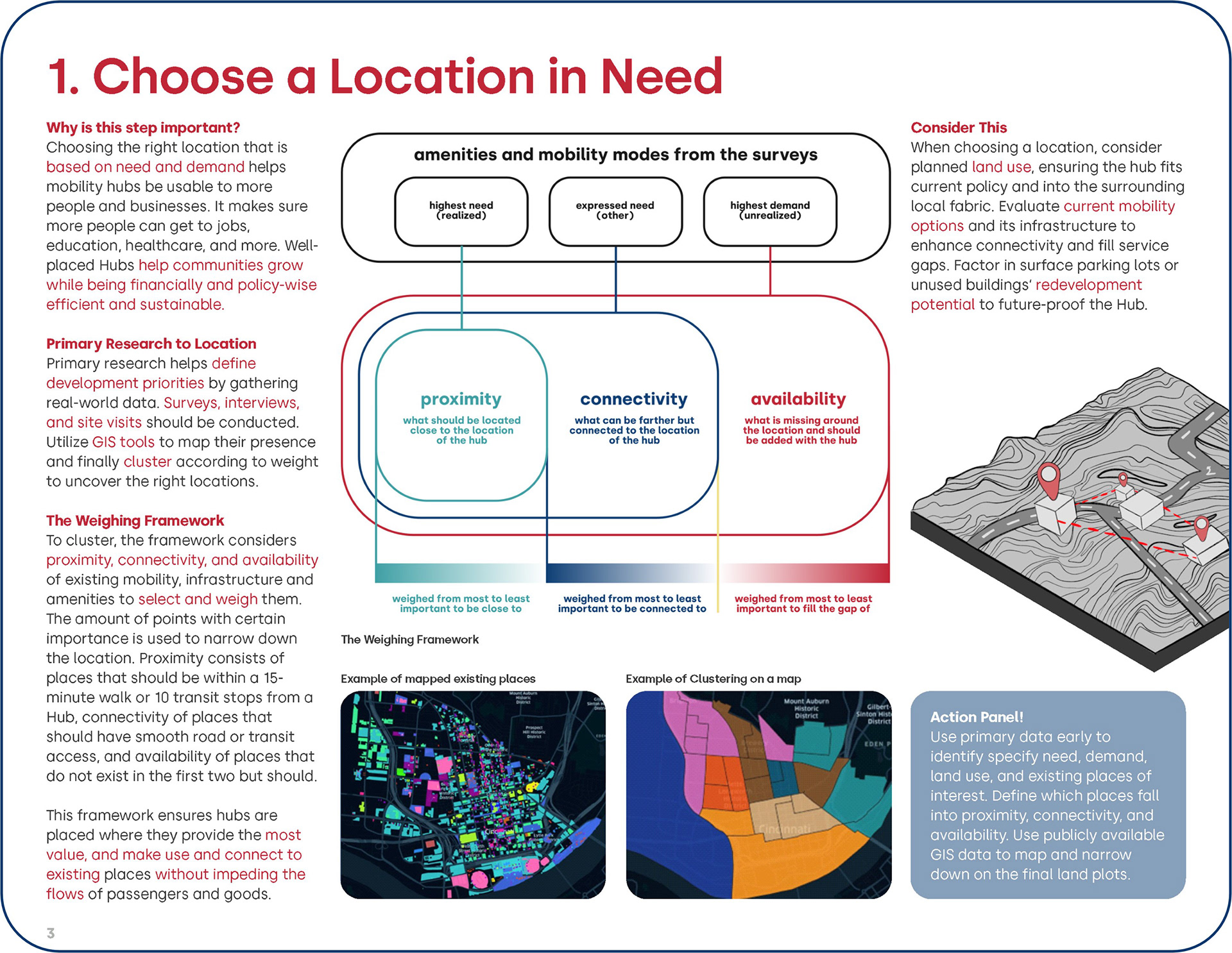
Why Community and Mobility Hubs?
•Address access as a systemic challenge, not just a transportation issue, by integrating mobility with essential services such as healthcare, education, employment, and social infrastructure.
•Position hubs as community anchors that support long-term economic development, resilience, and equitable access across urban, suburban, and rural contexts.
•Analyzed global access gaps and future-ready hub models to identify how integrated infrastructure can improve mobility, inclusion, and quality of life.
•Established a foundation for proposing inclusive, people-centered hub frameworks tailored to Ohio’s diverse communities.
Phase 1: Understanding
• Established a user-centered, data-informed baseline of mobility access, service gaps, and community needs across urban, suburban, and rural Ohio.
• Conducted IRB-approved primary research including stakeholder interviews (n=20), statewide surveys (n= 80), and on-site observations with residents, planners, transportation experts, and local leaders.
• Integrated secondary research through STEEP analysis, trend forecasting, policy review, and spatial and land-use analysis using GIS and regional planning datasets.
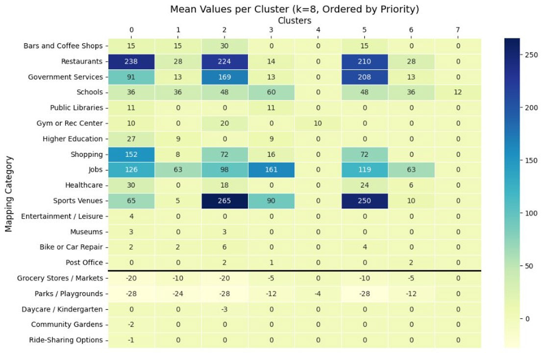
• Synthesized findings into clear insights, defining a Future Hubs typology matrix and selecting 9 case studies, creating a shared evidence-based foundation for design, simulation, and participatory decision making.
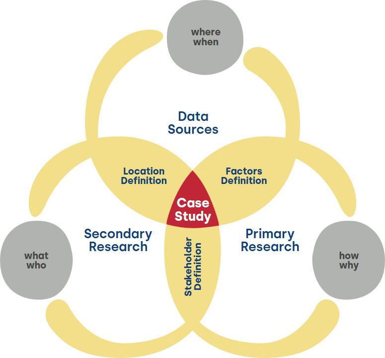
Case Study Definition
•Applied a proprietary 3-layer methodology integrating primary research, secondary research, and contextual datasets to define representative Future Hub case studies across Ohio.
•Primary inputs included IRB-approved interviews, surveys, and field observations capturing lived experience, needs, and priorities across diverse communities.
•Secondary inputs included STEEP analysis, Generative AI scenario validation, policy review, and trend forecasting, supported by quantitative datasets such as GIS, land use, demographic, and mobility data.
•Synthesized these layers to identify access gaps, opportunity areas, and hub typologies across urban, suburban, and rural contexts, ensuring case studies were evidence-based, human-centered, and scalable for design, simulation, and participatory planning.
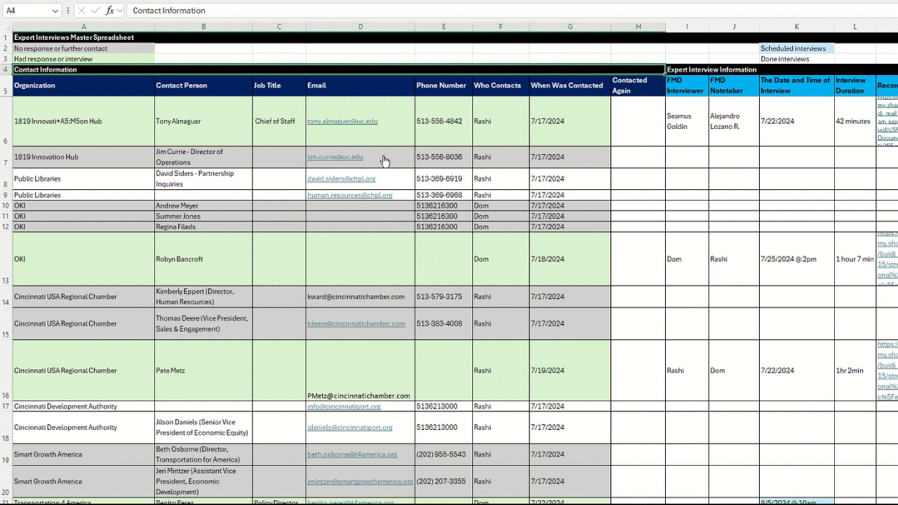
Stakeholders Contact List
A 100+ stakeholder list was created, to document potential partnerships for ODOT across local businesses and industries, universities, non-profit organizations and state-level entities. This list is a very valuable resource for ODOT, which we have leveraged in the next 3 grants that came after this project.
Quantitative Stakeholder Survey
A large survey was distributed across the state, reaching over 80 responses from stakeholders across various industries, entities, and communities. The purpose was to assess their daily needs (transportation and other factors), and get their opinions on potential mobility hubs in the future.
Secondary Research
•Conducted STEEP analysis, trends forecasting, policy and planning review, and global precedent studies to understand systemic factors shaping access and mobility.
•Integrated quantitative datasets including demographic, land use, and mobility data to ground insights in measurable evidence.
•Established an evidence-based foundation to inform strategic decisions and define scalable hub typologies.
STEEP Factors
Extensive secondary research was conducted to understand the Social, Technological, Economic, Environmental, and Political factors affecting the State of Ohio's residents in terms of access to essential services like transportation, healthcare, education, and community spaces. Several rounds of research were conducted, each diving deeper into areas of interest, and resulting in key themes to explore.
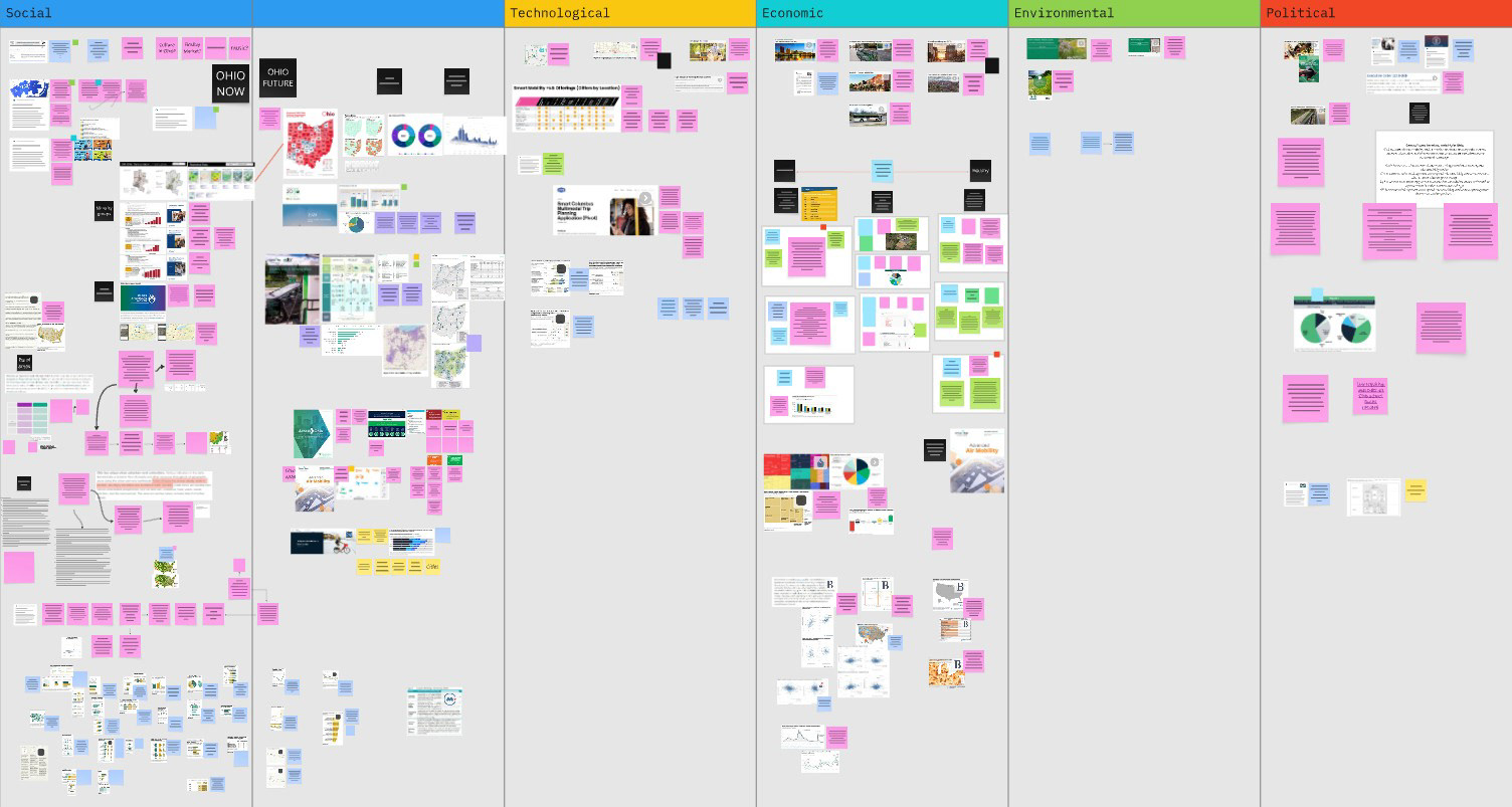
Overall caption of the first round of STEEP Factors research

Extract from Ohio's 2045 and Future Advanced Air Mobility Reports
Typology Matrix
•Developed a typology matrix through global review of mobility hubs and community infrastructure models, synthesizing best practices across transportation, urban design, and socio-economic development.
•Introduced a key innovation by including diverse land-use contexts (urban, suburban, rural, and central areas), avoiding one-size-fits-all solutions.
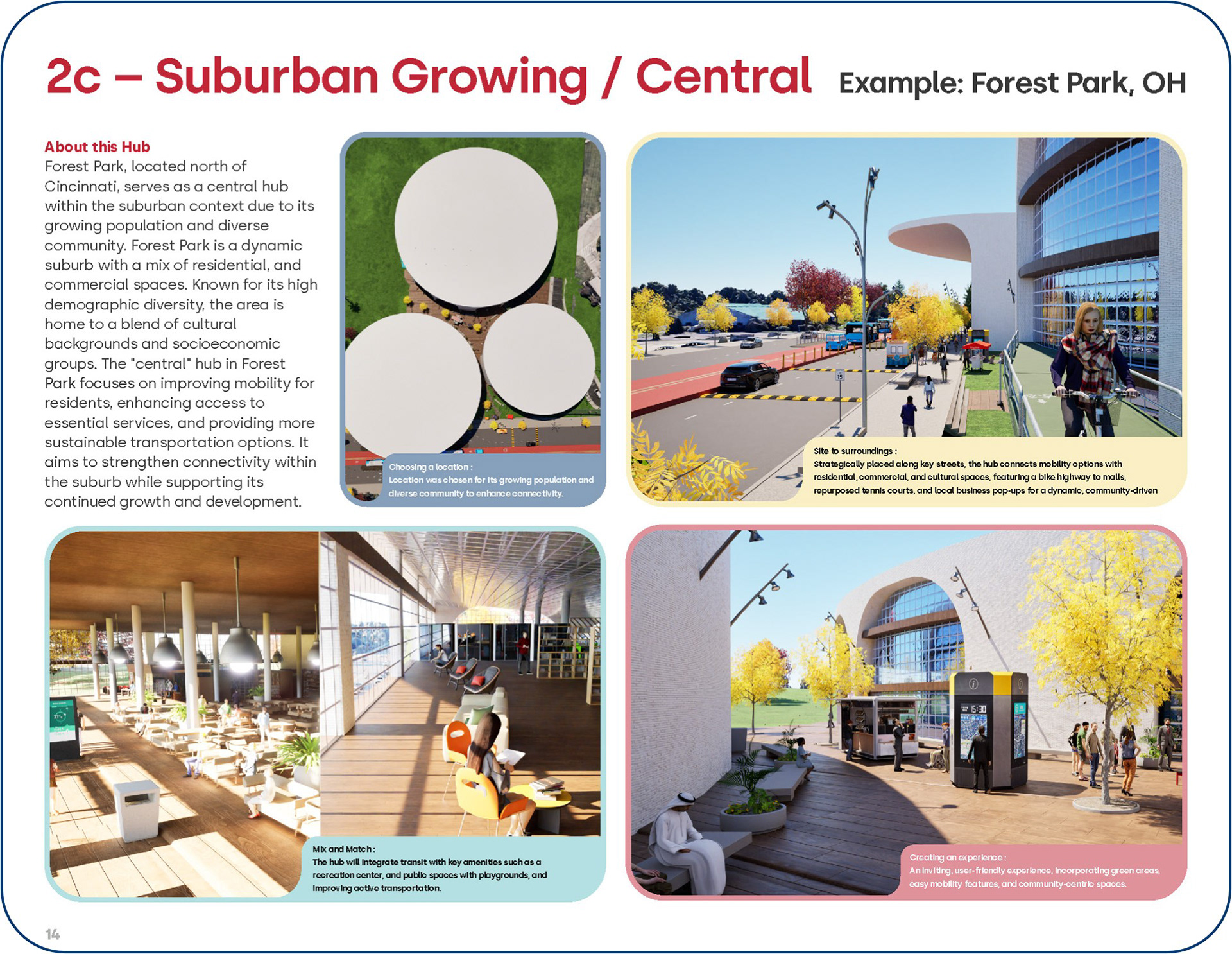
•Defined 9 scalable hub types, each grounded in global precedents, validated with regional data, and containing specific design requirements.
•Designed the matrix as a context-adaptable framework, allowing variables to be adjusted for national and international application across diverse geographic and cultural settings.
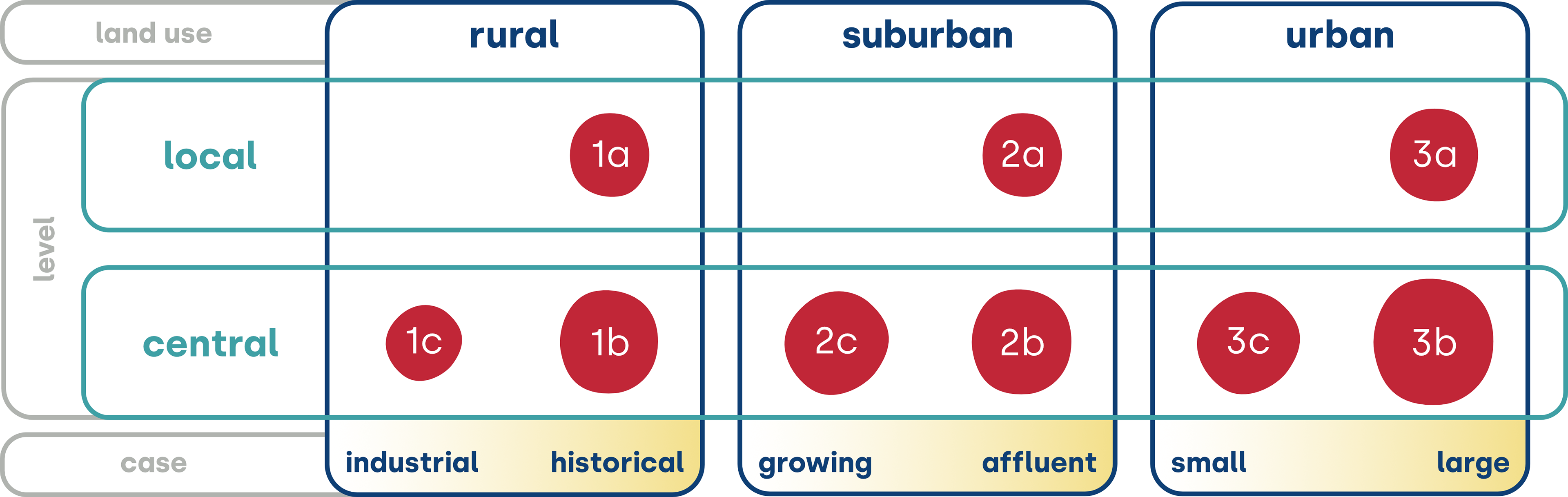
9 Future Hub Typology Matrix
Phase 2: Ideation
•Translated qualitative and quantitative research into 9 actionable hub concepts using proprietary UX and systems-based ideation methods, which included Generative AI exploration, each aligned with local needs and long-term policy goals.
•Mapped survey, interview, and secondary research insights onto the Typology Matrix to define case-specific requirements across architecture, urban planning, mobility systems, user experience, and services.
•Developed 9 Digital Twin hub concepts, transforming research into immersive, spatially accurate environments for validation, comparison, and stakeholder engagement.
Translation Framework
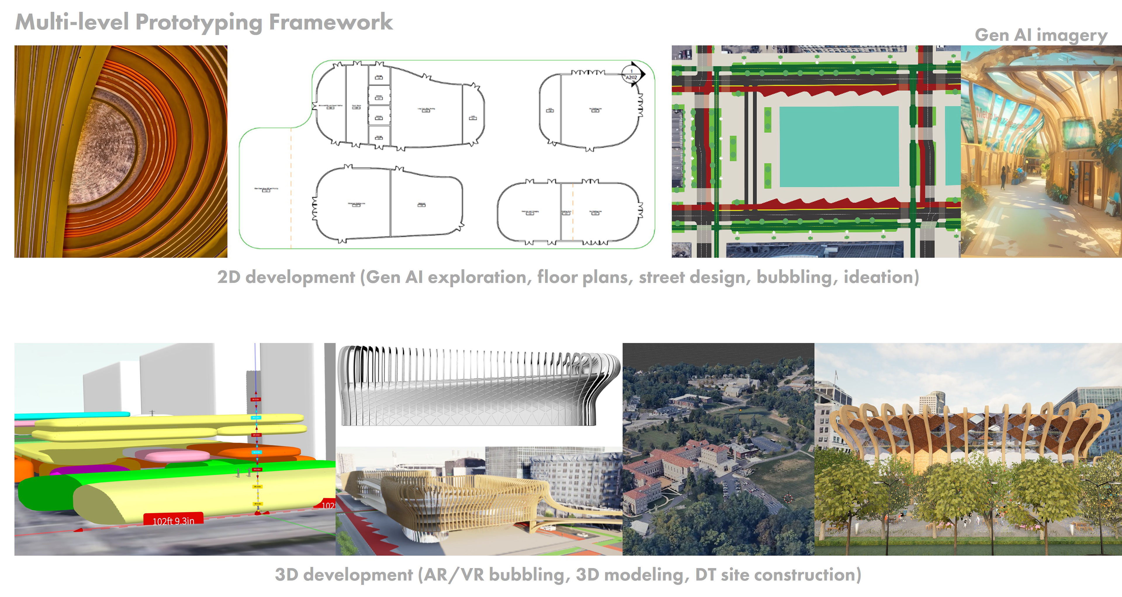
•Applied proprietary multi-level prototyping methods to translate research insights into spatially 9 grounded hub concepts, beginning with bubble diagrams to define functional requirements and planning constraints.
•Advanced concepts through sketching, Generative AI concepting, 3D modeling, and collaborative AR/VR exercises in Gravity Sketch to evaluate scale, usability, and human interaction before detailed development.
•Integrated local datasets, including land use, mobility, and demographic data, and iteratively validated designs through stakeholder feedback to ensure each hub remained aligned with community needs and scalable across contexts.
Phase 3: Refinement
•Consolidated selected hub concepts into decision-ready proposals integrating spatial design, services, mobility systems, and implementation considerations, aligned with research findings and local policy constraints.
•Further developed Digital Twin hub models as validation and co-design tools, enhancing spatial accuracy and usability for stakeholder workshops.
•Enabled participants to test scenarios, assess trade-offs, and provide structured feedback, resulting in refined, implementation-ready hub concepts to support future planning and engagement.
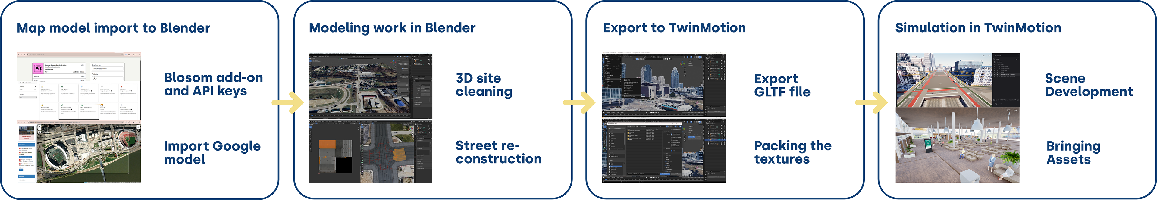
Digital Twin Simulation Framework
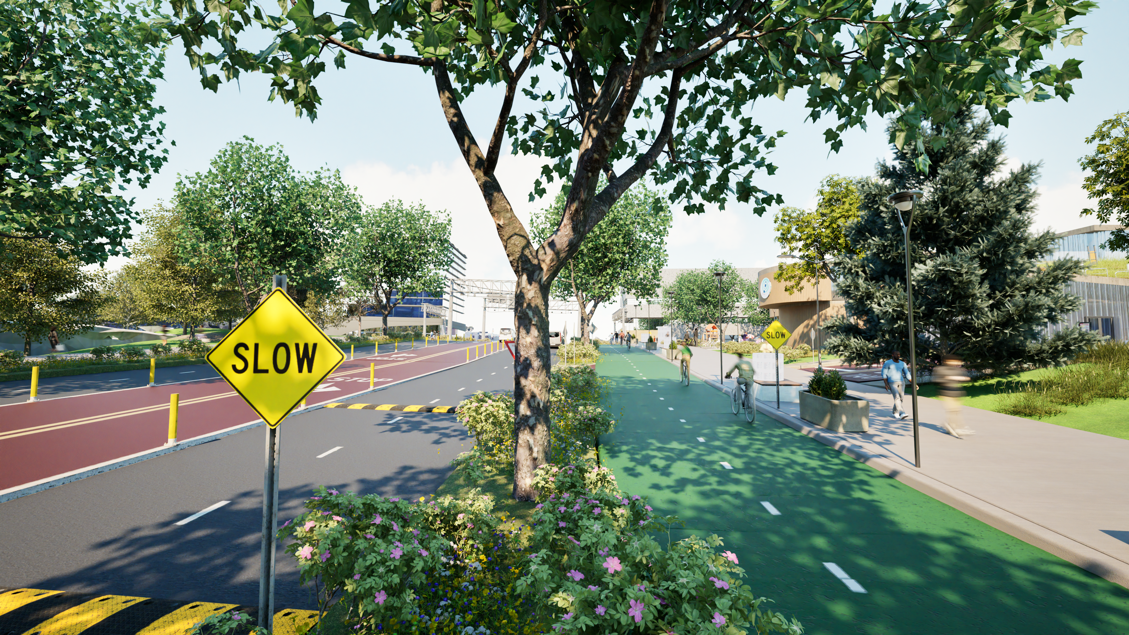
•Translated planning and design concepts into immersive, interactive Digital Twins using TwinMotion, integrating site data, spatial layouts, architectural elements, and environmental context.
•Developed realistic, walkable, VR-compatible simulations that allowed stakeholders to visualize pedestrian activity, multimodal traffic flows, and hub amenities in real time.
•Created a shared visual platform that aligned data, planning assumptions, and community vision, enabling scenario comparison, early validation, and informed decision making in stakeholder workshops.
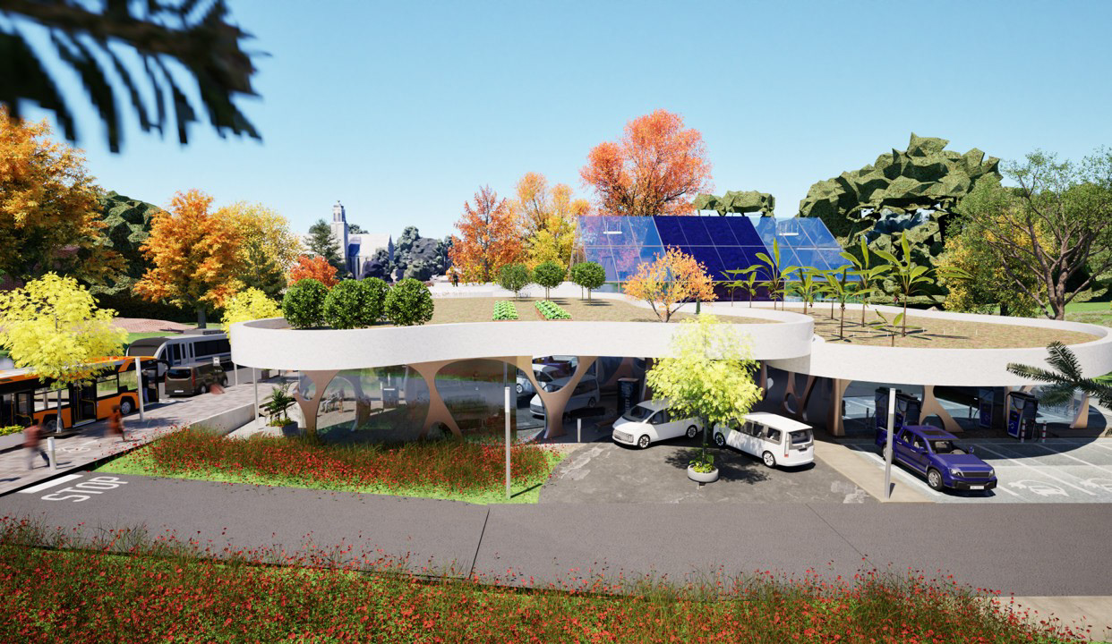
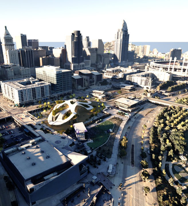
Final Hub Digital Twins
•Alongside Immersive VR experience, 9 high-fidelity Digital Twin videos were produced, one for each hub typology defined in the Typology Matrix, to be used during stakeholder workshops.
•Created immersive walkthroughs illustrating spatial layout, multimodal movement, pedestrian experience, and key program elements.
•Provided an accessible visualization tool for stakeholders to understand, compare, and evaluate future hub scenarios.
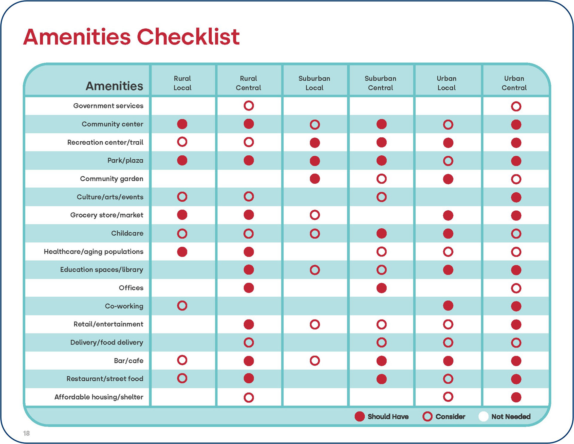
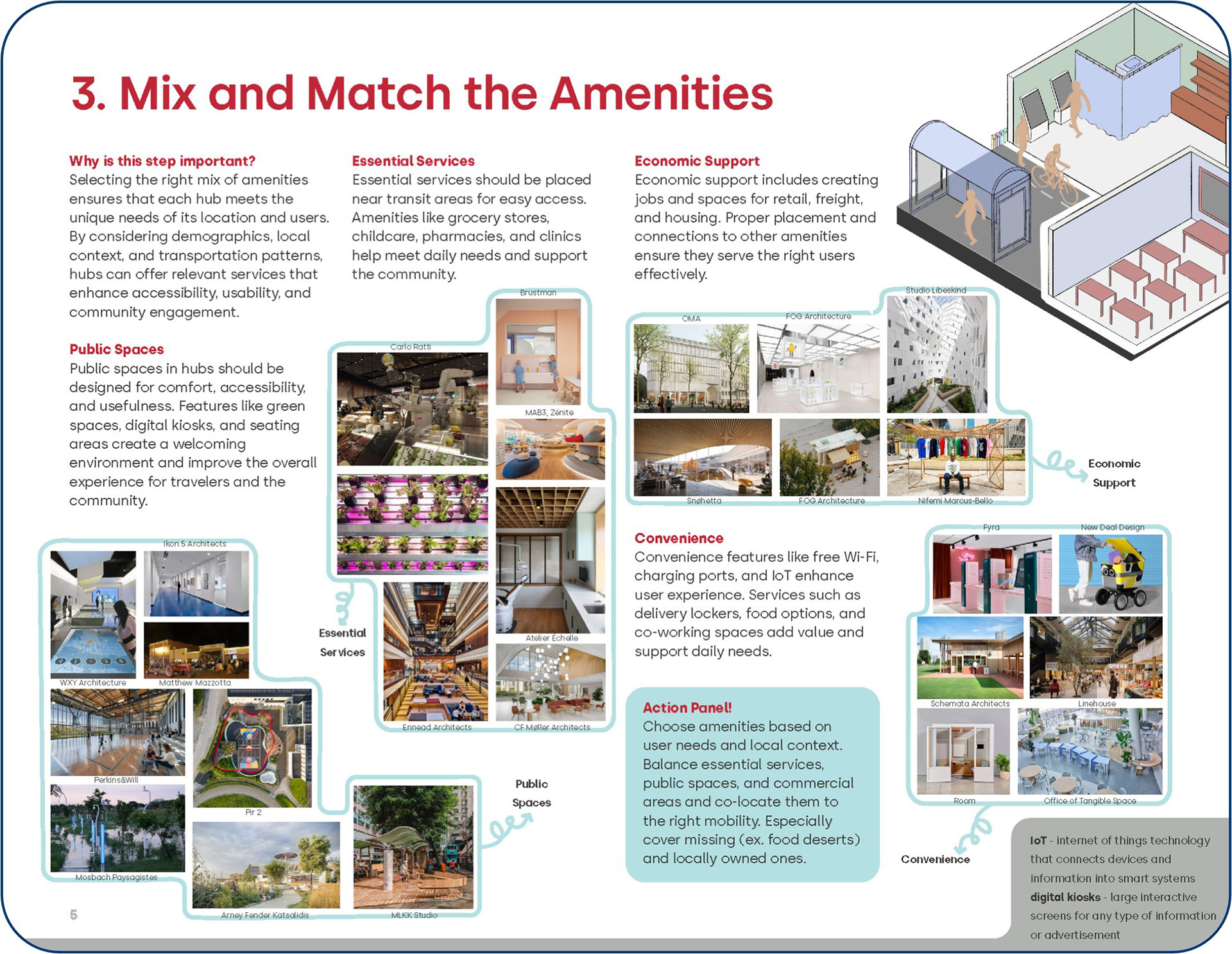
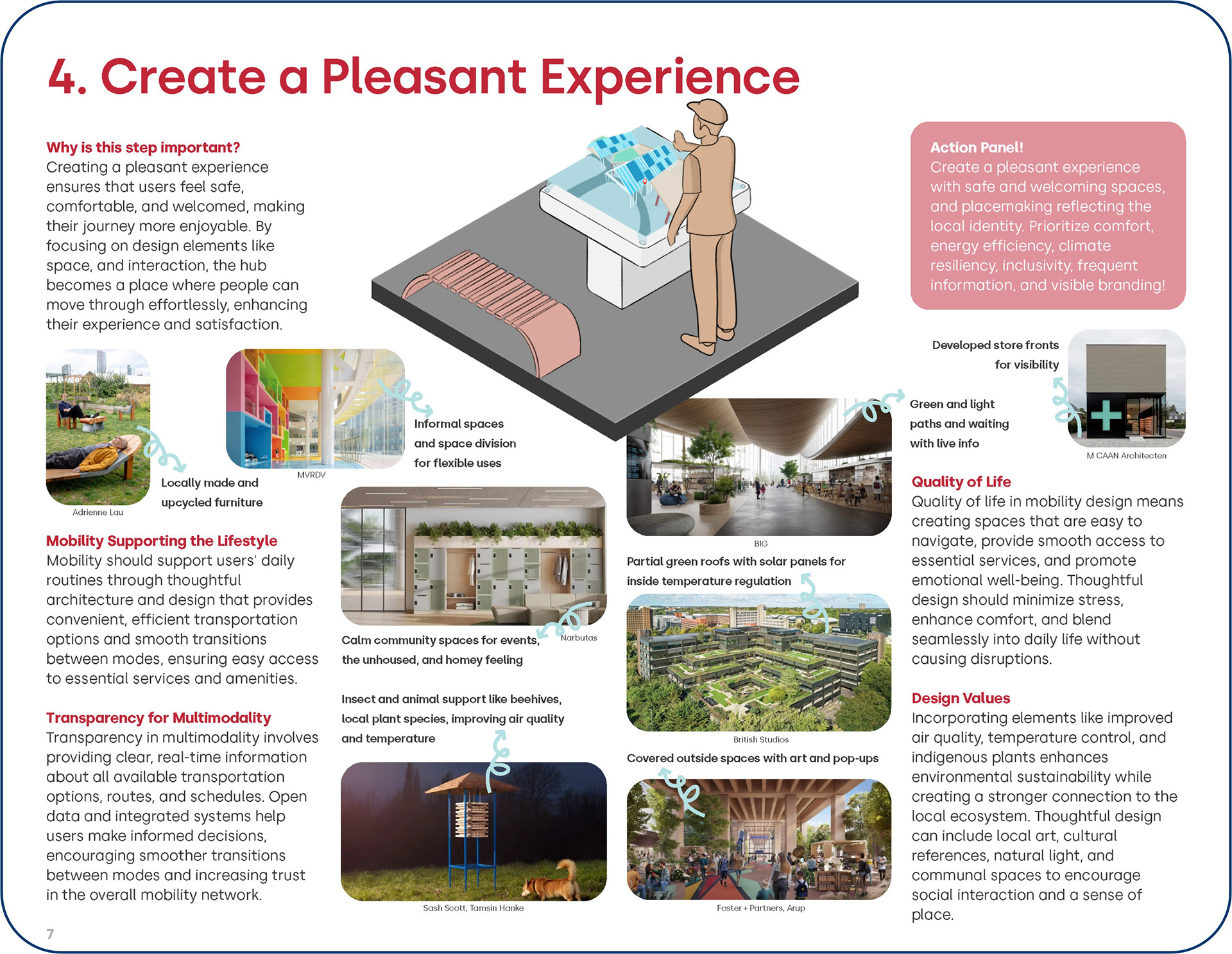
Future Hub Playbook: A Participatory Framework for Hub Planning
•Created a participatory, data-informed toolkit translating research into actionable guidance for planners, policymakers, and communities.
•Designed to support collaborative planning, design, and evaluation of community and mobility hubs that improve access to essential services and quality of life.
•Grounded in user-centered research and supported by Digital Twin simulations, enabling structured yet flexible application across urban, suburban, and rural contexts.
•Empowers communities to define local priorities, assess trade-offs, and co-create context-specific hub strategies without relying on one-size-fits-all solutions.
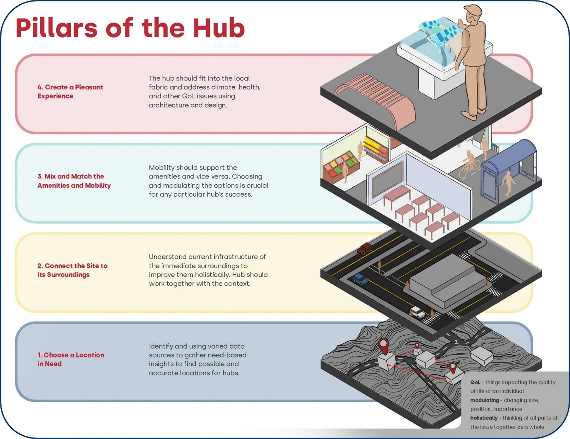
4 Hub Pillars
•Structured the Future Hub Playbook around 4 interconnected pillars, guiding stakeholders from understanding community needs to defining typologies, translating insights into design decisions, and validating scenarios through Digital Twin visualization.
•Supported each pillar with research insights, Digital Twin examples, and practical checklists to simplify complex planning and design decisions.
•Designed as a flexible, facilitation-ready framework that adapts to local social, spatial, and policy contexts rather than prescribing fixed solutions.
•Lowers barriers to civic engagement by combining user-centered research, data-driven insights, and immersive technologies into a shared, accessible planning process.

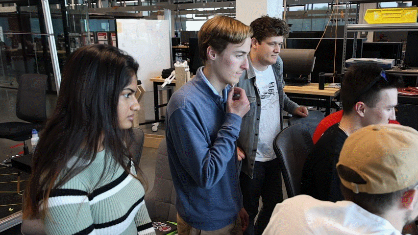
50+ Community Stakeholder Workshop (Click image for YouTube video)
Phase 4: Next Steps
•Transitioned the framework from pilot to implementation through professional and public engagements including OTEC 2024, ODOT Future Mobility and All Aboard Ohio webinars, and collaboration with the City of Cincinnati Port Authority.
•Incorporated feedback from planners, policymakers, transportation experts, and community members to refine the Playbook and Digital Twin tools.
•Positioned the framework for deployment across Ohio in partnership with ODOT, while expanding nationally and internationally through the MIT City Science Network and partners in the Global South and Europe.
•Established a scalable, globally adaptable model for inclusive, technology-enabled infrastructure planning focused on access, equity, and quality of life.
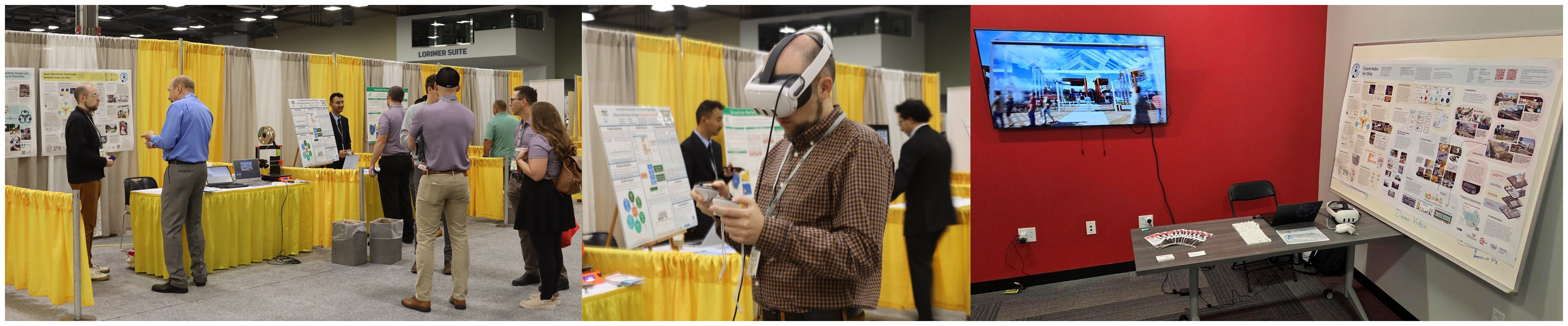
Various professional conference and events were Future Hubs framework was validated
5.1 Digital Twins as Democratizing Tools
•Translated complex planning data into immersive, accessible environments to support informed and inclusive decision making.
•Enabled alignment between technical experts and non-technical stakeholders by visualizing land use, mobility systems, and community amenities in a single platform.
•Developed 9 high-fidelity Digital Twins using game engine technology to support early validation, scenario testing, and shared understanding.
•Demonstrated strong potential for broader adoption through XR platforms and open frameworks, especially for under-resourced municipalities.
5.2 The Future Hub Playbook as an Empowerment Tool
•Shifted from static planning documents to a participatory framework that empowers communities to shape future hub strategies.
•Shifted from static planning documents to a participatory framework that empowers communities to shape future hub strategies.
•Translated research into clear prompts, visual examples, and actionable checklists to support priority setting and trade-off decisions.
•Validated through early stakeholder feedback in Ohio, demonstrating scalability and usability across diverse contexts.
•Functions as both a technical guide and facilitation tool, lowering barriers to civic engagement and supporting inclusive decision making.
5.3 From an Ohio Pilot to Global Application
•Designed in Ohio but built for global adaptation across diverse socio-political and urban contexts.
•Designed in Ohio but built for global adaptation across diverse socio-political and urban contexts.
•Expanded through active collaborations with the MIT City Science Network and partners in the Global South and Europe.
•Positioned as a scalable framework for future hub case studies focused on improving access, equity, and quality of life worldwide.
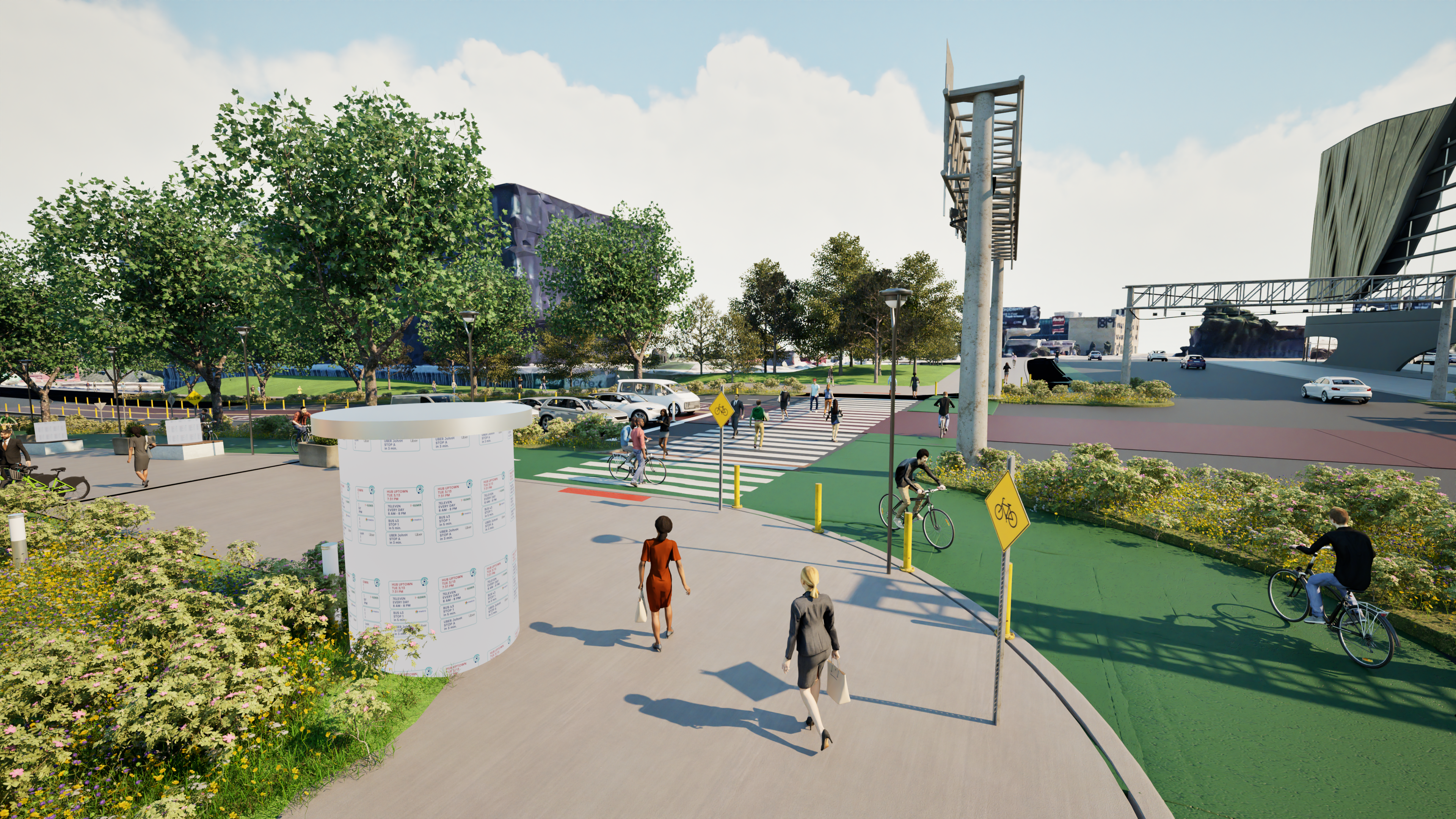
Image from one of the 9 Digital Twin concepts
Interested in more information?
While this project includes publicly shareable frameworks, methodologies, and pilot outcomes, certain implementation details and future applications remain under active development. I would be glad to discuss the design research process, participatory methodologies, Digital Twin framework, and strategic planning tools in more detail, including how they can be adapted to specific community, policy, or organizational contexts.